Nathan Gill and Dr. Matthew Bekker, Department of Geography
This study was the first step in a larger effort by the Wasatch Dendroclimatology Research (WADR) group, consisting of researchers at Brigham Young University and Utah State University, to develop a better understanding of hydroclimatology in northern Utah. Our specific goals were to develop preliminary reconstructions of streamflow beyond the historical record for the Provo and Weber Rivers and Big Cottonwood Creek, all important contributors to the water resources of the heavily urbanized Wasatch Front.
We hypothesized that such a reconstruction could be derived from the measurement of tree rings sampled from forests across Northern Utah. Pencil-sized samples were taken with increment borers, doing no serious harm to the trees. Samples were then measured under a microscope to the nearest nanometer. Trees grow one ring each year, and the width of that ring is largely dependent on the amount of moisture available to the tree. Drought years can be detected when a very narrow ring is present. A tree-ring chronology can be established by combining numerous samples. The chronology can extend far back into time as samples of dead trees are fund to have overlapping patterns with living trees. We know the dating of the living trees is correct because the outermost ring represents the year that the sample was taken.
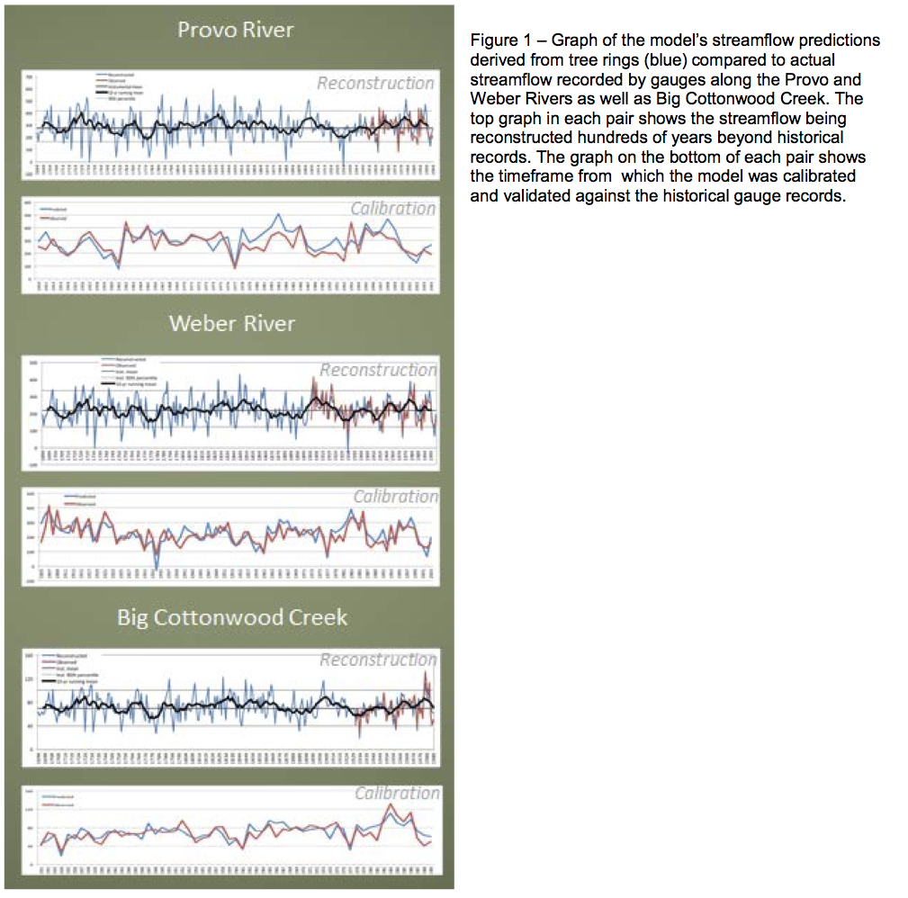
We then compared the chronologies with half of the data available from streamflow gauges along Big Cottonwood Creek and the Provo and Weber Rivers to calibrate our model to accurately derive streamflow from tree-ring width. We checked the accuracy of our model by comparing its predictions to the other half of the historical streamflow data. The then repeated this process to check with opposite halves of the dataset as well.
Accuracy was measured through four different statistical tests: R2, the Sign Test, Reduction of Error and Coefficient of Efficiency. All four tests found the model to have significance in its ability to reconstruct the streamflow of all three rivers of interest.
The models suggest that over the past 300 years, this region has experienced more frequent and more severe drought periods than current historical records account for, yet these inadequate records are the primary basis for water resource management in Utah today (Gray, Stephen T., Jackson, Stephen T., and Betancourt, Julio L. 2004. Tree-ring based reconstructions of interannual to decadal scale precipitation variability for northeastern Utah since 1226 A.D. Journal of the American Water Resources Association 40: 947-960). Models of all three rivers suggest that a drought period in the late 1770s and into the early 1780s was longer-lasting and more severe than anything that has been observed by the historical record.
Further research is needed to extend the reconstruction more than 300 years back in time. Sampling of more dead, older trees and possibly trees from other locations to reconstruct the streamflow of other rivers will improve the robustness, temporal length and utility of the reconstruction model. Research is currently under way to locate and sample other moisture sensitive sites.
Results from this study were presented at the Ira and Mary Lou Fulton Conference 2012, the National Conference on Undergraduate Research (NCUR) 2012 and published in the NCUR proceedings (Gill, Nathan. 2012. Preliminary Reconstructions of Streamflow for Three Rivers in the Southern and Central Wasatch Front, Utah. Proceedings of The National Conference On Undergraduate Research, Weber State University, Ogden Utah).

